DART
Introduction
Dublin Area Rapid Transit (DART) data is scraped from an open API providing real time updates to passengers. The rail service runs from Howth and Malahide in the North to Greystones and Kilcoole in the South.
Station locations along the Dublin coast and through the city centre are shown on the map above.
Data on delays on the network are provided for each train currently running. This data is analysed in near real-time by the tool to provide alerts for newsworthy changes in trends.
Data trends
Each time the data is scraped the mean and maximum delay across the network of running trains is calculated. The graph below shows how these statistics vary throughout a typical week in January 2019.
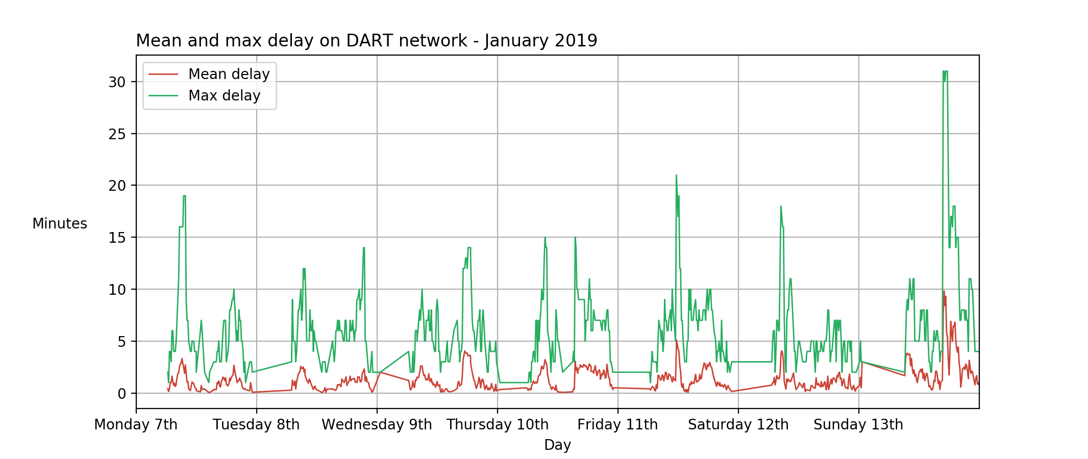
The area between each of the vertical gridlines represents a calendar day. Spikes in the mean and maximum delay appear in the morning and evenings on weekdays matching peak usage during typical commuting hours.
Alert parameters
Subscribers are able to change the values of the parameters used in the regular analysis of the data. This gives the subscriber full control of their alerts, which are raised when trends in the data change or exceed the thresholds set, possibly indicating newsworthy events.
To get access to alerts on real datasets or a demo of how subscribers can easily set their own parameters for data alerts use the contact button in the menu bar above.
Sources
Data is scraped from the Irish Rail real time API. It is published by Irish Rail and is not modified by Alert Data Journalism. The data is provided by the original publisher under Creative Commons Attribution 4.0, meaning it can be shared and adapted for commercial purposes. This service provided by Alert Data Journalism is not endorsed by the publisher.